Three Centuries on the Bayou: An Interview with Cassie Pruyn
Benjamin Morris speaks to author and poet Cassie Pruyn about the many histories of Bayou St. John.
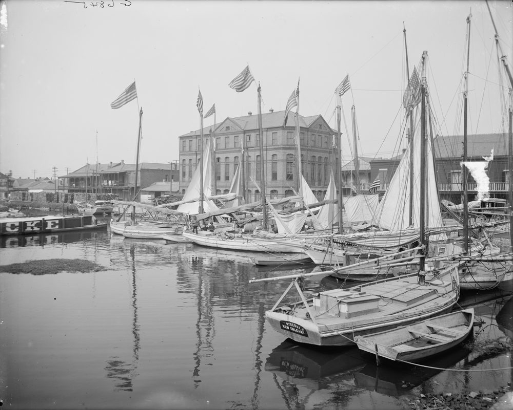
Oyster and charcoal luggers in the Old Basin Canal, New Orleans, c. 1910. via Wikimedia.
Editor's Note
One of New Orleans’ most cherished public spaces, Bayou St. John is also one of its oldest and most historic, serving alternately as meeting place, environmental landmark, shipping corridor, drainage outlet, residential settlement, and even, festival ground. Poet and author Cassie Pruyn is writing a new history of this beloved waterway, due out from The History Press in 2017. Benjamin Morris sits down with Pruyn to learn more.
Benjamin Morris: How did you come to be writing a history of Bayou St. John, and what is the need for such a book?
Cassie Pruyn: Until beginning this project, I was a poet first and foremost. My poetry often engages with geographic history, and New Orleans geographic history in particular, so the subject matter of this book was a natural extension. I’ve always been drawn to bodies of water and their direct and indirect relationships to human development, culture, and thought. As any New Orleans resident knows, neighborhoods in this city are vibrantly distinct, each with its own rich history, and so I was also interested in the ways in which Bayou St. John influenced the neighborhoods that grew up around it over the past three centuries.
This area of the city has yet to be written about in any comprehensive way. We have an incredibly thorough history of the bayou during colonial times, published in 1980 by Edna B. Freiberg, but we don’t yet have a volume that tells the story from prehistory through the present day. I believe this body of water and its surrounding neighborhoods are incredibly important spaces within the city of New Orleans; their stories can deepen and enrich our understanding of the city’s history in general. The bayou has changed and shifted as the city has changed and shifted, and it has a lot to tell us about what it means to build a city on land created and defined by water.
BM: Bayou St. John is one of the oldest inhabited spaces in New Orleans, with colonial traffic dating back to the city’s founding, and indigenous traffic dating before that. Can you describe its historical importance to the city’s growth and development?
CP: Throughout the last three hundred years, the bayou has been logistically, commercially, militarily, and recreationally significant to the growth and development of our city. Many New Orleans residents are aware of the bayou’s role as part of the portage route Native Americans showed the French in the late 17th century, which influenced Bienville’s decision to found New Orleans on this particular curve of the Mississippi River. Instead of navigating the Mississippi’s treacherous mouth, settlers could instead travel from the Gulf of Mexico through Lake Borgne into Lake Pontchartrain, down the bayou to a footpath several feet higher than the surrounding cypress swamp, which in turn led to the banks of the river. The same ridge system that allowed for the high and dry footpath meant that land surrounding lower Bayou St. John was some of the only other land, aside from the Mississippi’s natural levees, suitable for development and agriculture at the time. The lower bayou was home, therefore, to the very first European settlers in the area in 1708, a full ten years before trees were felled for what we now call the French Quarter. Throughout the 18th century, the land around the bayou and what is now Bayou Road boasted numerous large Creole plantations—forming the city’s first “faubourg,” or suburb, a rural outpost of the burgeoning city.
BM: What are the main milestones in the development of the bayou since 1708?
CP: The first Bayou St. John milestone after 1708 is the digging of the Carondelet Canal in 1794, a feat that required landowners to “lend out” their personal slaves in order to complete this grueling public project. The Old Basin Canal, as the bayou and the Carondelet Canal together were often called, became a crucial commercial conduit, allowing for transport of goods from the Gulf Coast and the lake directly to the edge of the Quarter. For the next century, the Old Basin’s banks served a primarily industrial purpose, peppered with shipyards, breweries, furniture factories, lumber yards, and sawmills. Beginning in the 1920s, after more than a century of use, the Carondelet Canal was incrementally filled in. The bayou was then “beautified” in the 1930s, declared non-navigational, and transformed into an unofficial extension of City Park. Soon after, the bayou served briefly as a means of transport for Higgins World War II vessels, and now, particularly in the wake of Hurricane Katrina and its aftermath, the bayou is very much a part of the conversation surrounding sustainability and flood protection for the city going forward.
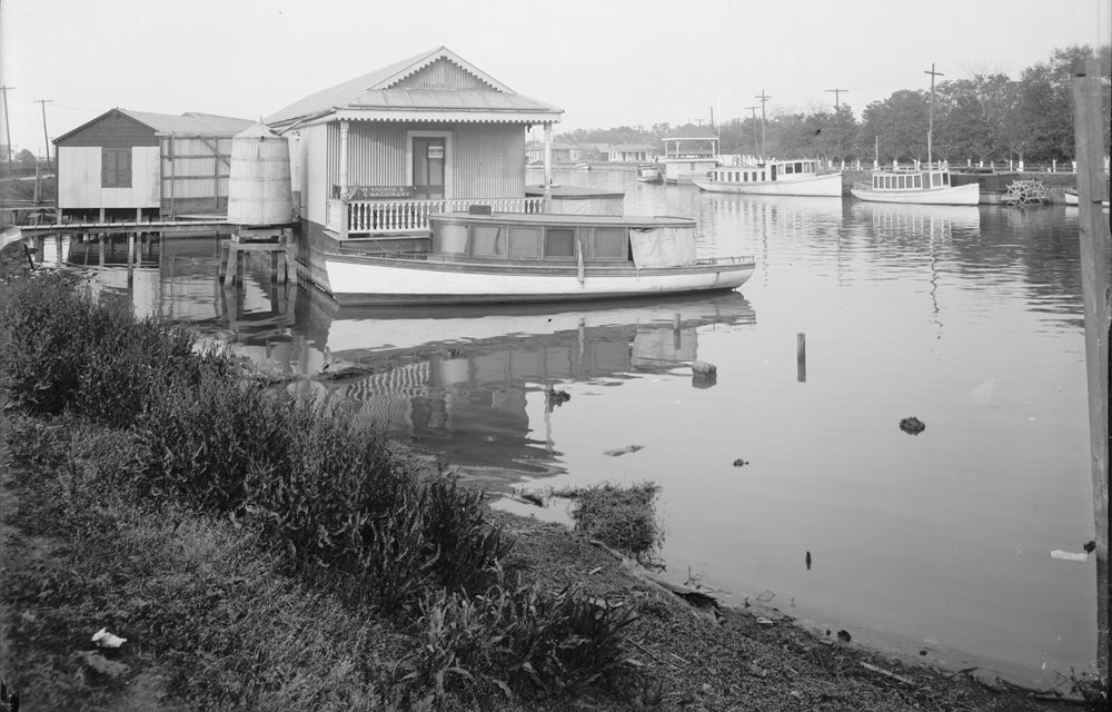
Bayou St. John, New Orleans, 1910. via Wikimedia.
BM: How has use of the bayou and the surrounding area changed over time? What uses were once present that we no longer see, and what uses have emerged in modern times that did not previously exist?
CP: Standing on its banks today, it’s hard to imagine a wild bayou fed by numerous small streams, choked with logs and weeds and islands and alligators. Or, standing below Esplanade, it is hard to picture the hardwood forests, dairy cows, citrus orchards, and large green plantations bearing stately Creole plantation-style homes that once defined the area in the 18th century. It’s equally hard to imagine the ship traffic that developed soon after—those massive schooners gliding along, and the Magnolia Bridge (which was once the bridge at Esplanade, before it was transported via barge to its current location in 1908) pivoting to let them pass. Or, further toward the lake, a cypress swamp, eventually opening out into grassy marsh, shell-lined beach and brackish lake. Or sprawling shipyards with elevated wooden skeletons. Or houseboats with names like “French Duck,” “Black Gold,” “Lindy Ann,” or “Little Bit” that littered the bayou in the 1920s and ’30s. Or Higgins boats that turned the bayou into a parking lot during World War II. Or the process of bayou beautification, which required draining the bayou, exposing centuries-old cypress stumps and many decades worth of human refuse from when it had been an outlet for the city’s waste.
BM: Understandably, given such a precious natural resource, questions of ownership and control of the bayou recur throughout its history. From what you have learned in your research, what have been the main tensions?
CP: In combing through the historic Times-Picayune database, I was amazed to see how often the various uses of the bayou, and therefore questions of ownership and control, were hotly debated. Historically, the bayou served as a natural drainage outlet. But once it had come into its own as a commercial conduit, questions of its use as a drainage canal recurred: residents in the vicinity of the bayou complained consistently about a nasty smell, and attributed the stench to whatever the New Orleans Gas Works had been dumping indirectly into it, not to mention the rest of the city’s waste. Board members of the Carondelet Canal and Navigation Company, which controlled the Old Basin from 1805-1908, along with politicians, engineers, and residents argued over whether the bayou ought to be used for drainage as well as for commercial use, until it was decided to divert city’s waste into a new system of canals built specifically for drainage.
The question reemerged in the first two decades of the 20th century: what should the bayou be used for? Should we envelop it into the park system as a crucial public resource, or should we continue to use it commercially, despite significant competition from the railroads?
So there’s the question of the bayou’s use at any particular period, and then there’s the question of the tension between technical ownership and literal control. In the 18th century, France, and then Spain, regulated all aspects of the Louisiana colony, including use of its waterways. But there were always issues of smuggling and avoiding tolls owed to the crown (this may be why the “Custom House” on the corner of Moss Street and Grand Route St. John still has remnants of an iron jail cell: although never technically used as a custom house, it may have been unofficially used as a holding pen for smugglers and debtors). When the Carondelet Canal and Navigation Company had control of the bayou, they charged notoriously steep tolls for its use and for use of the shell roads alongside it, fees against which the public enthusiastically fought. Then there was the apex, so to speak, of tension between technical ownership and actual control during decades of litigation limbo between the Carondelet Canal and Navigation Company and the state, when a lack of control, fees, and oversight turned the bayou into an ad-hoc floating neighborhood full of houseboats, its banks cluttered with docks and boathouses of all shapes and sizes. From then on, the public has been heavily involved in deciding the rules and uses for the bayou and its banks. In the 1920s and ’30s, residents of the Bayou St. John neighborhood, led by future-mayor and Faubourg St. John resident Walter Parker, fought houseboat, boathouse, and shipyard owners tooth and nail to create the bayou as we know it today. When considered alongside these past conversations, our current debates over use of the bayou’s banks for festivals and other recreational activities continue to express the themes of public use that have defined the bayou since the city’s founding.
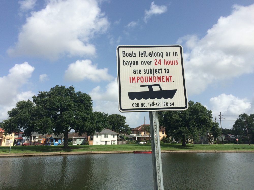
Bayou St. John in 2015. Photo by Cassie Pruyn.
BM: Other public spaces in New Orleans similar to the bayou include the Fly at Audubon Park and the Moonwalk in the French Quarter, both overlooking the Mississippi River. Does exploring the history of the bayou inform our understanding of, or relationship to, these other iconic spaces?
CP: Although I don’t know much about the development of Woldenberg Park along the riverfront in the French Quarter, or the Fly in Audubon Park, I know these specific sites were transformed into how we know them today in the 1960s through ’80s. However, Audubon Park at large was developed much, much earlier than that. City Park and Audubon Park were both once privately owned plantations that the city eventually acquired. Once effective drainage technology was developed in the late 19th century and City Park’s middle and upper stretches were sucked clean of swamp, City Park bloomed into the vision the city had for it, matching Audubon in intentionality and sophistication. So I consider the pressure to add the bayou to this park system and the development of a recreational space along the river in Audubon Park to be closely related. By contrast, the decision to transform the former industrial space on the Mississippi River levee in the Quarter into a site of recreation happened much later in the city’s history—in the 1970s and ’80s. This type of decision, I imagine, weighed issues of flood protection, control and ownership of the river and its banks (the Army Corps of Engineers versus the city) with issues of industry and public use. Obviously, these issues overlap with issues surrounding use of the bayou, but take on a scale commensurate with the body of water in question.
BM: Your book doesn’t just explore a public space, it actually relies on the public for material—stories, images, ephemera, and documentation—in order to tell the story of that space. What specifically are you seeking during the research phase, and how can the public contribute to this project?
CP: This project relies on New Orleans residents, particularly those who live (or have previously lived) in the neighborhoods in the vicinity of the bayou. As you mentioned, I am of course interested in photographs and other documents, but I’m also interested in hearing stories about life on the bayou during previous eras—the atmosphere, the way residents conceived of their relationship to the waterbody and their particular neighborhoods, and other personal memories. Nothing is irrelevant in this regard—every piece of information adds to the narrative in its own way. Anyone interested can visit my website, cassiepruyn.com, for contact information and bi-weekly blog entries on what I’ve been learning about our beloved bayou.